Offline-first area intelligence
A desktop intelligence suite that maps the terrain, people, infrastructure and threats around you - and works offline when the grid doesn't.
What's inside
WATCHMAN turns public data into a working intelligence picture of the place you live - the way a professional would build it, without the professional's budget.
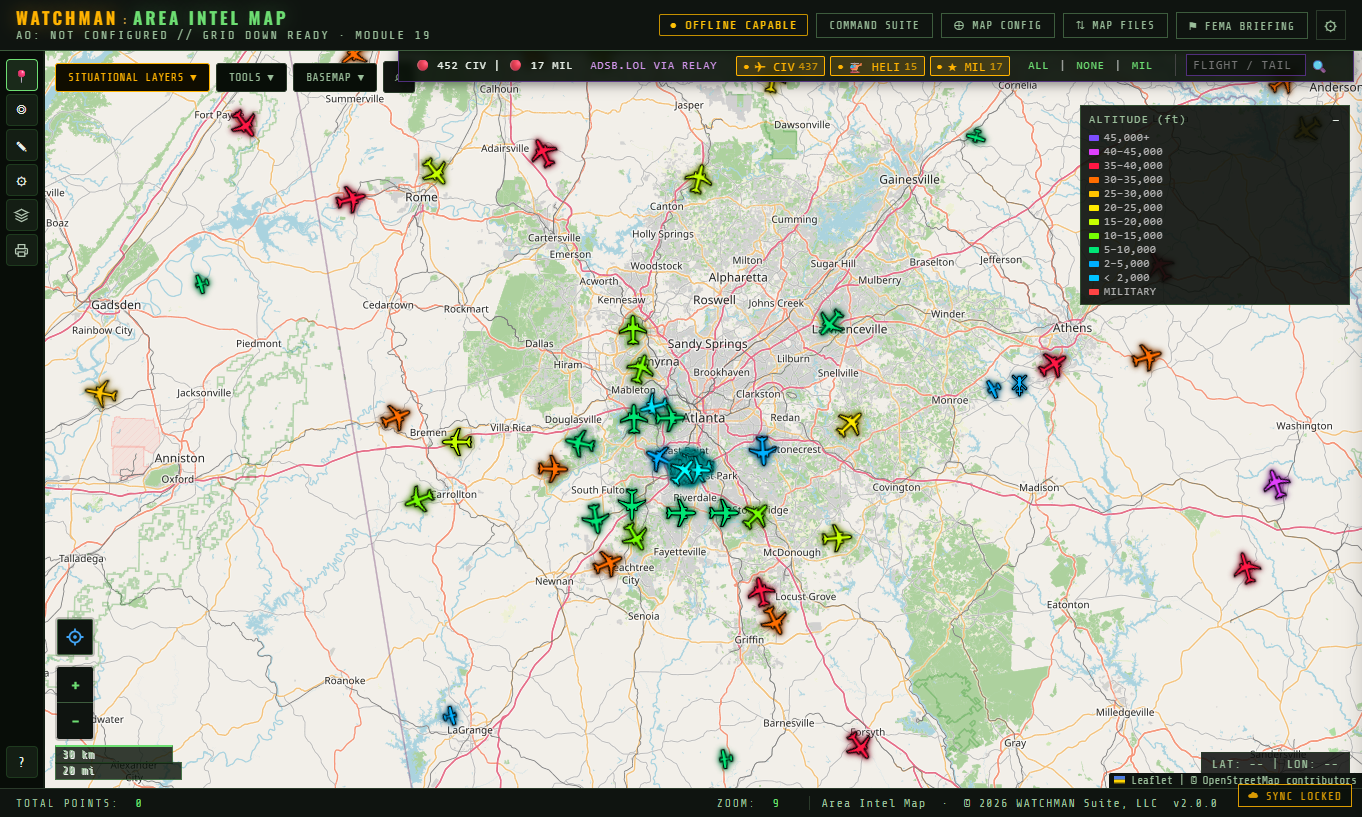
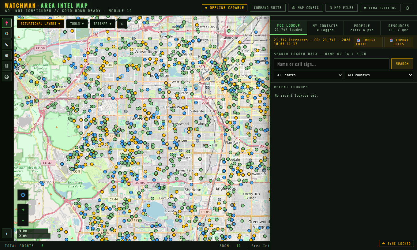
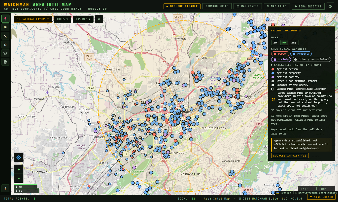
A tactical map of your area with 170+ layers you can turn on and off - terrain, water, power, hospitals, radio, crime, routes and more. Right-click anywhere to ask "what's here?"
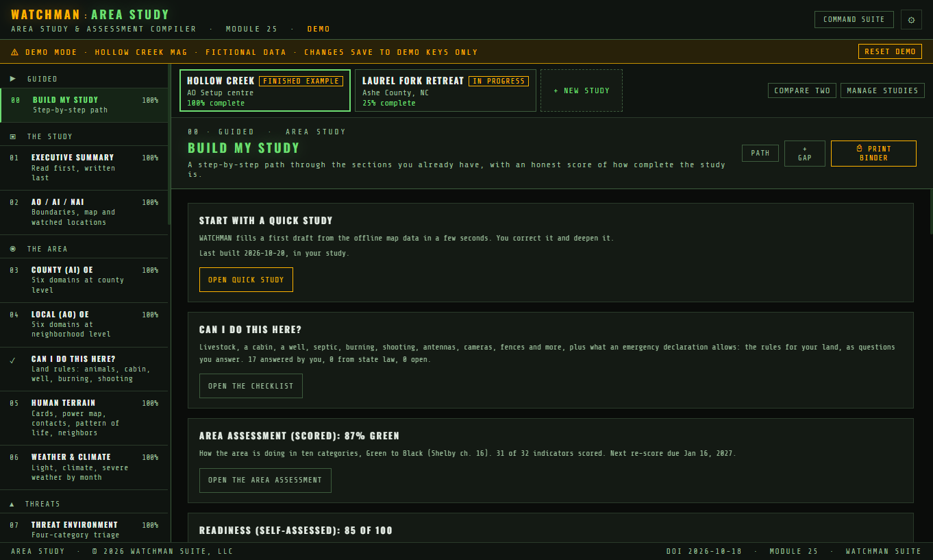
A guided workbook that walks you through a complete study of your area - the six layers of the operational environment, the threats, the routes, the people who make decisions - and prints a binder.
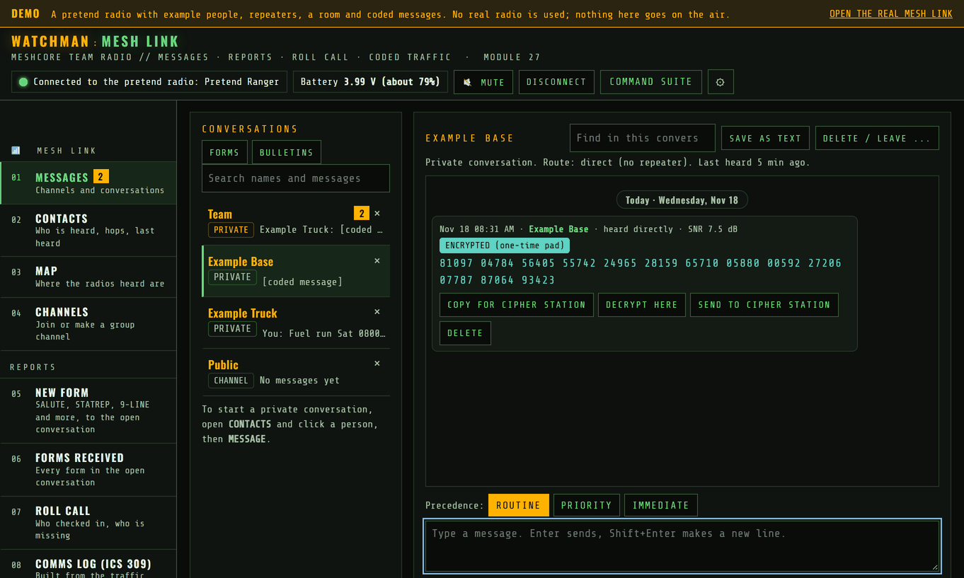
Talk to your group when the phones and internet are down. MESH LINK runs your team's messages over small MeshCore radios, radio to radio through repeaters - no cell towers, no accounts, no monthly fee.
See it in action
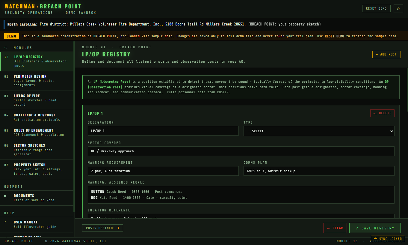
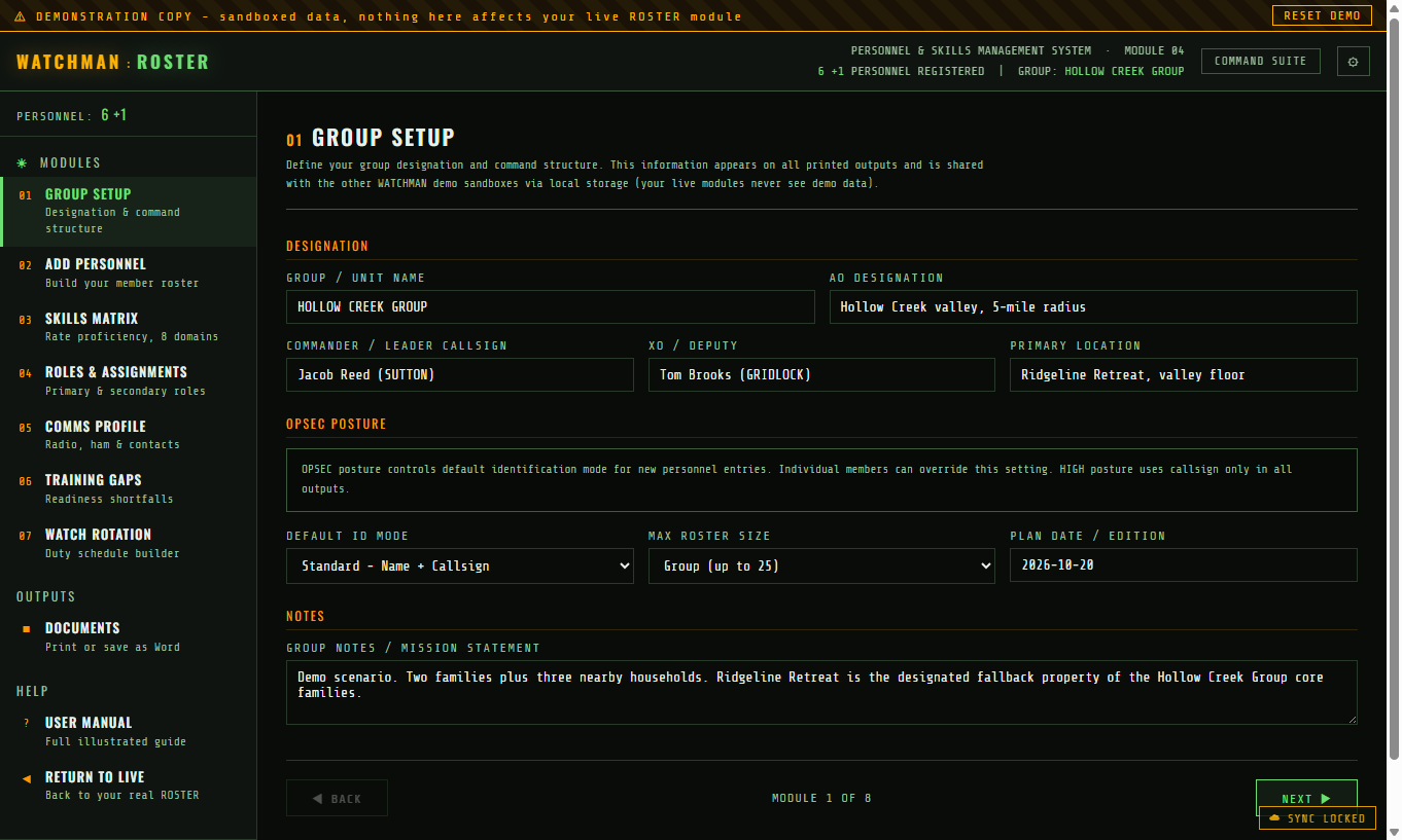
All 28 modules come with it, plus the LIBRARY, each built from public data and filled with a complete worked example you can learn from. Every one is included in the single price.
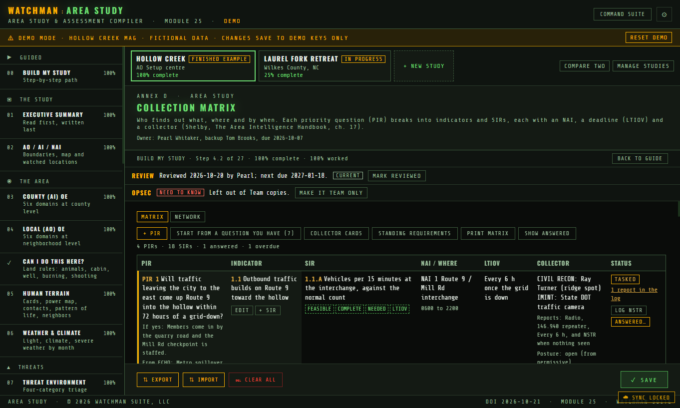
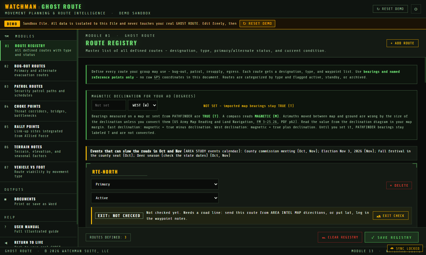
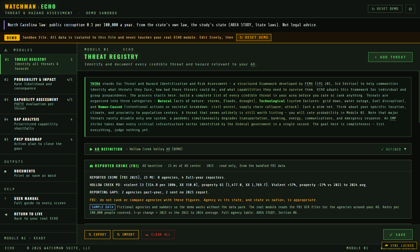
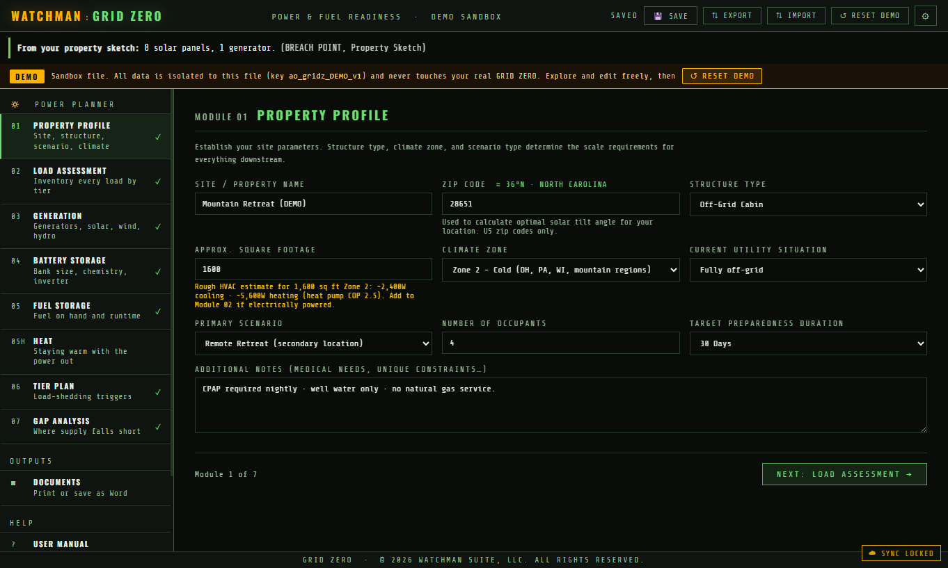
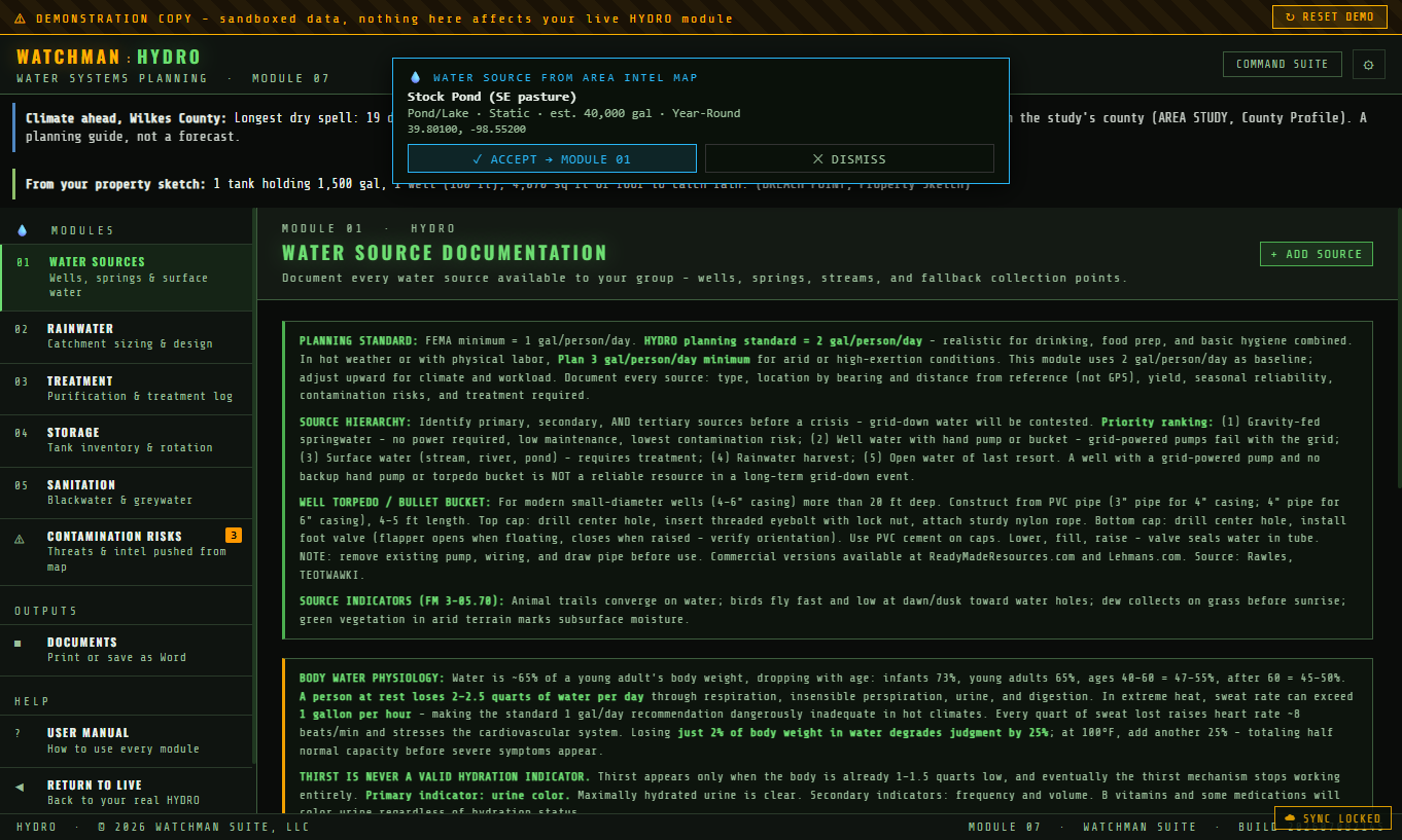
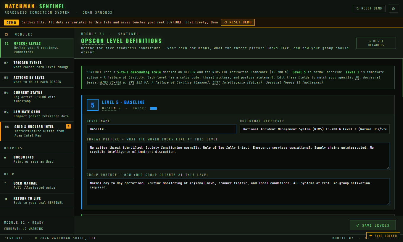
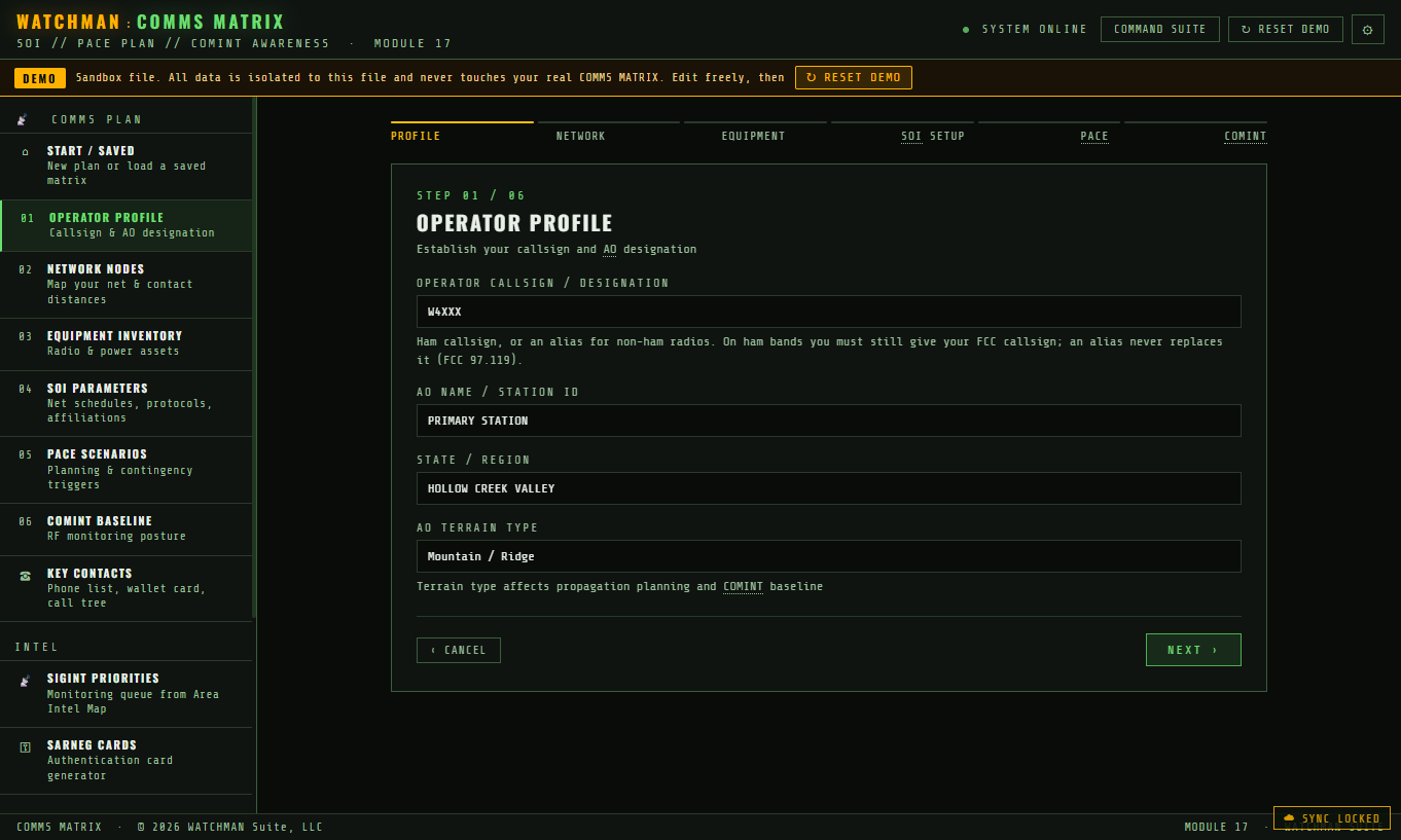
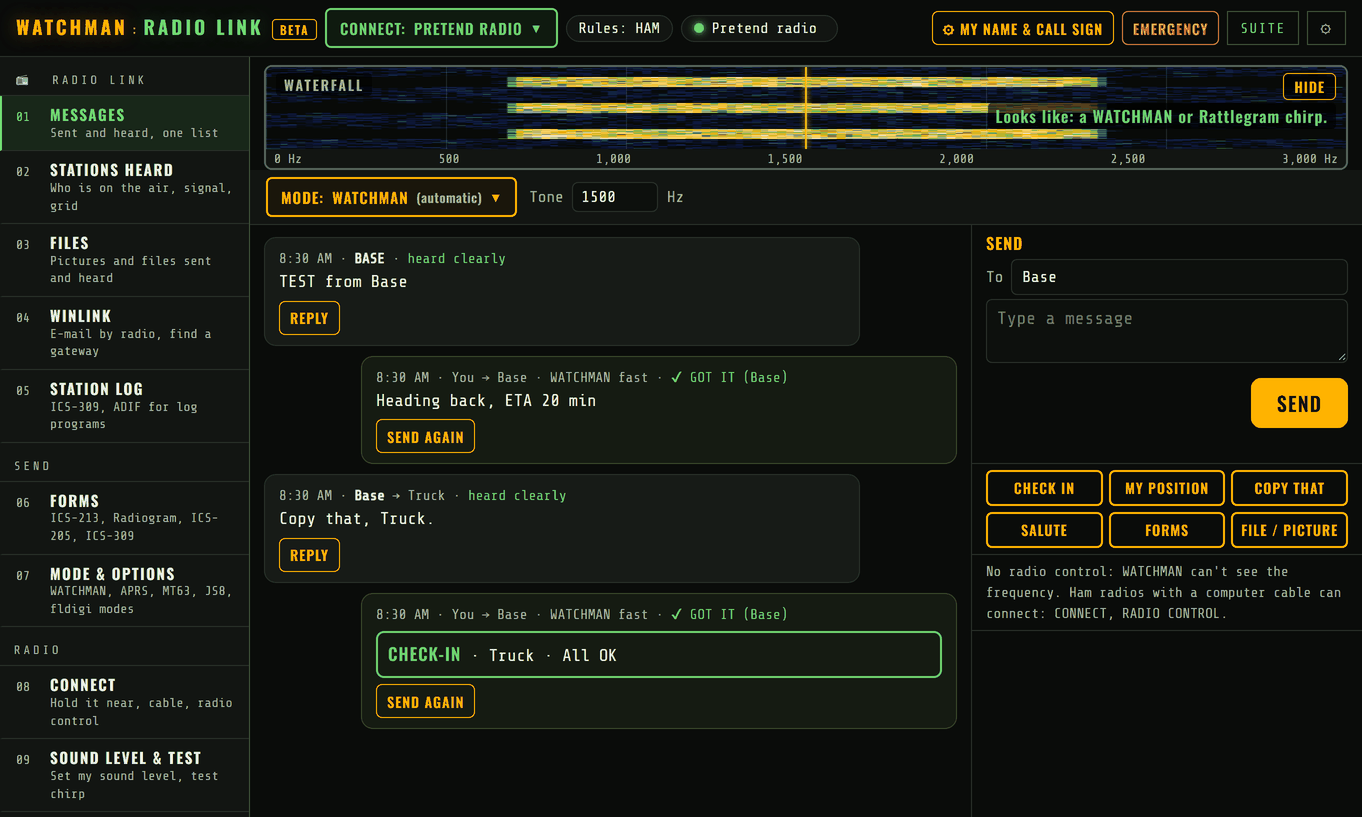
What's included
Every module below ships in the desktop app - built from public data, filled with a worked example, and documented.
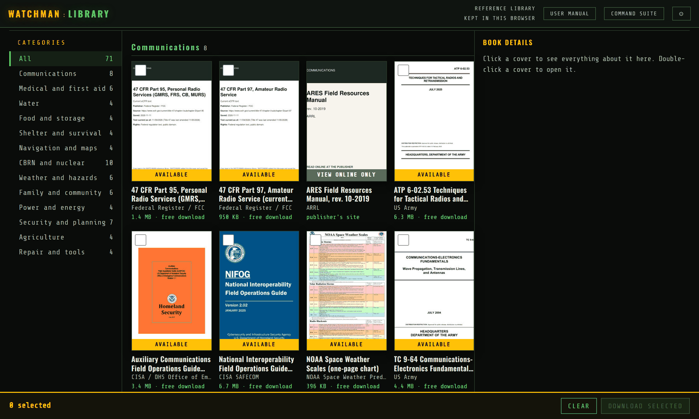
Also included: LIBRARY. Your books, manuals and documents, offline and searchable. Add your own, link your Calibre library, or pick from free guides such as NIFOG, FEMA and Army field manuals.
Never stare at a blank screen
You are never dropped into an empty tool and left to guess. Every module has a built-in manual, and the planning modules come with a worked demonstration you can practice in - built right in, no internet required.
Every module has its own complete manual inside it - what it is for, how to work it, and the doctrine behind it - one click away while you work.
A demonstration version of each planning module comes already filled out with a realistic example, so you can see exactly what a finished, properly used module looks like.
The demonstration copy doubles as a safe sandbox: click, type and experiment freely without touching your real work - practice until it clicks, then start your own.
The data
Every layer is pulled from official and open sources, pinned to real locations, documented and refreshed regularly - so what you see is current and you can check where it came from.
Elevation, slope, flood zones, landslides, wildfire risk, dams, bridges and the water that shapes movement.
Demographics, key leaders, election results, local government, critical infrastructure and who keeps it running.
Crime records, law-enforcement and fire/EMS coverage, hazmat sites, and a framework to rank what matters to you.
Repeaters, licensed hams, scanner frequencies, broadcast coverage and a radio card built for your location.
Road networks, fuel, food, medical and routes. Turn-by-turn directions need the internet; the routes you save work offline.
Aircraft near you and weather alerts, with your own receiver supported if you have one.
Most of the data lives on your own machine, not on someone else’s server - so a busy server or a dead link can’t take it from you at the worst possible moment. The fast-moving layers that have to be live - aircraft, weather alerts - stay live; everything else is downloaded and ready without a connection. Behind the scenes our own server watches the sources around the clock and keeps the data refreshed, so what you carry is both current and reliable.
“I'm Jason. I have more than 30 years of combined experience in law enforcement, hurricane response and damage assessment, and building inspections and planning, and I've been a prepper since the early 1990s. When I went to do my own area study, I couldn't find a single finished example to learn from. So I built the tool that makes one.”
Read why I built WATCHMAN →Pricing
Buy once, own it. Windows, Mac, Linux and Android tablets included, with regular data updates.
How it works
Checkout securely with Stripe - card or wallet.
A license key and download links land in your inbox.
Grab the installer for Windows, Mac or Linux.
Open it, paste your key, and the first data pack loads.
Security & privacy
WATCHMAN is built for people who care about where their data goes. The answer is: nowhere.
The app and its data live on your machine. Your studies, routes and notes never touch our servers.
Your data pack and every Area Study tool work with the internet off. Download offline maps for your area and the map works grid-down too - the whole point of a grid-down tool. A few layers (aircraft, active weather, protests) are live by nature and need a connection.
Installers download straight from our own servers and the app runs on your own machine. Because WATCHMAN is from an independent developer, Windows may show a one-time SmartScreen prompt the first time - choose More info → Run anyway. The download page walks you through it.
Questions
Buying and license
No. It's a one-time purchase and the app is yours. (We may offer an optional annual plan later for people who want it - your purchase stays yours either way.)
Your license key comes by email within a minute or two. Download WATCHMAN for your computer from the Download page, open it, and enter the key. That is all.
One license covers up to 5 devices for one person or household - your own machines, including a desktop, a laptop, a Raspberry Pi, an Android tablet or a phone. It is meant for your family, not for sharing beyond it.
Each household needs its own license. But group members can share their work digitally: AREA INTEL MAP exports pins, routes and overlays as map files (KML, KMZ, GeoJSON, GPX) or as a password-locked file and imports what others send, and each module saves its own files to share - by email or a USB stick. With no internet at all, MESH LINK carries messages and reports between radios. Buying for 10 or more? Ask about bulk pricing.
Yes, for 10 or more licenses bought together - for example a ham club, a prepper or survival group, a retreat, or a CERT or emergency management team. Email info@watchmansuite.com with how many you need and who they are for, and we will reply with a quote.
Not yet. WATCHMAN is built for the United States: most of its map layers come from U.S. government sources and would be empty anywhere else, so for now we sell only to customers in the U.S. The planning tools work anywhere, and we hope to cover more countries later.
15-day money-back guarantee, no questions asked.
Computers, tablets and phones
Windows 10/11, Macs on macOS 13 (Ventura) or newer, and Linux - including the Raspberry Pi 5. One purchase covers all of them.
Android tablets (8 inch and up) get WATCHMAN from Google Play and unlock it with the same license key. An iPad app is on the way. Phones get WATCHMAN FIELD: a pack of your area made on your computer, opened on your phone with no signal needed, plus notes and photos you send back to your computer. A full phone app is on the way.
8 GB of memory (16 GB is better), about 6 GB of free disk for the app and data pack, and internet for setup and updates.
New programs show a Windows notice until their publisher's signing certificate is in place, and ours is being issued now. The installer is the one from watchmansuite.com; choose More info, then Run anyway.
Install WATCHMAN on the new computer and enter your key. Bring your work across with a backup file from Settings.
Offline and the data
Only to download the app and its data updates. After that, the WATCHMAN data pack and every planning tool work with the internet off. Map backgrounds work offline once you download them for your area with the built-in offline map manager. A few AREA INTEL MAP layers are live by nature, so they need a connection when you use them.
Only the things that are live by nature: aircraft overhead, weather radar, NOAA Weather Radio streams and live alerts. Everything else - 170+ layers, your plans and your notes - is on your machine.
Every U.S. state and county. Most layers cover the whole country; a few, like parcel lines, cover some states so far, and each layer says exactly where it reaches.
Official and open public sources - government agencies, open datasets and public records - each one documented and dated inside the app.
Data updates come every month, and each one lists what changed on the Update history page. Every layer shows its source and the date it was pulled.
That is exactly why most of the data lives on your own machine instead of being pulled live from someone else’s server. A busy server, a dead link or a thin connection cannot take it from you - the data pack is already downloaded and ready. Our own server works around the clock watching the sources and refreshing the data, so what you carry stays current.
Privacy and security
No personal data leaves your machine. See our privacy policy for the details.
No. Set your area by any town, ZIP or spot on the map, and it stays on your computer.
The people registry, the map, the vault and other sensitive modules can be locked with a password and are encrypted on your disk.
Yes. Save a backup file from Settings any time, and restore it on the same or another computer.
What it does
Families, neighborhood and mutual-aid groups, CERT teams, ham and GMRS operators, and anyone who wants to know their area before they need to. It is not a navigation app and it does not replace emergency services.
Those help you get somewhere. WATCHMAN helps you plan where you live: 170+ layers of hazards, infrastructure and resources, plus 28 tools for food, water, power, comms, people and plans - all offline.
One price, the whole country, every tool, and it works with no internet. See the Compare page for a side-by-side.
Much of it. AREA STUDY fills in your county's facts, hazards and infrastructure from the data pack; you add what only a local knows. A worked example shows what a finished one looks like.
Yes. MAP FILES imports and exports KML, KMZ, GeoJSON and GPX, and exports to ATAK.
Yes. Every module prints - plans, maps, wallet cards and a full binder - as PDF or Word, ready for paper.
Help
Every module has its own illustrated user manual, and the planning modules have a demo copy to practice on. For anything else, email info@watchmansuite.com.
Before you buy
 WATCHMAN